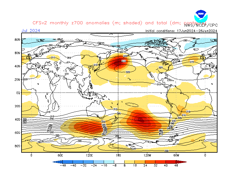
Not exactly on topic, but a spring discussion thread rarely fares well on TWO so I'll stick this here:

That's a pretty strong signal emerging for March from the CFS model. It translates to surface highs more toward Central/Eastern Europe with surface lows running close to the NW of the UK.
Potentially chilly at times if an easterly flow has any influence early in the month, otherwise a good chance of increasingly above average temperatures in a SW flow with variable surface conditions in the UK, driest in the SE.
Usual caveats apply - only one model, LRFs are often a bit hopeless, etc.
Looking on an broader time scale, here's the Met Office ensemble mean outlook for SLP across spring 2015 as a whole:

Another strong signal, this time for the Azores High to be strong and often displaced or ridging across the UK.
By contrast, the January update had a fairly strong negative pressure anomaly centered over Scotland. Though this was for Feb-Apr rather than Mar-May, it still suggests a fairly big shift in the model's ideas for a fairly large part of spring.
As usual, a similar setup then persists with only slight changes when looking at the Apr-Jun and May-Jul maps. Overall, that would be a very dry outcome for the SW in particular, but then this model suite does seem to have a habit of sticking with the same idea for months on end.
I do wish we could freely see mean charts for the upcoming month in isolation, but I guess they feel that would take some value away from the pay-to-access products that offer such focus.
If you have any problems or queries relating to TWO you can Email
[email protected] https://twitter.com/peacockreports 2023's Homeland Extremes:
T-Max: 30.2°C 9th Sep (...!) | T-Min: -7.1°C 22nd & 23rd Jan | Wettest Day: 25.9mm 2nd Nov | Ice Days: 1 (2nd Dec -1.3°C in freezing fog)
Keep Calm and Forecast On