In a full on SSW the temps at 30 hPa could reach near zero Celsius to Brian may need to adjust the scale to account for that... 
I agree with BHB with respect to being in an awkward period as far as the modelling is concerned. Basically the models are struggling to comprehend what is an unusual situation across the tropics at the moment, with multiple Kelvin Waves that have emerged from that big MJO event of the past couple of weeks adding a convective signal to the Indian Ocean at the same time as convection also persists in the Central Pacific. The balance of power between the two seems to be causing the models some issues.
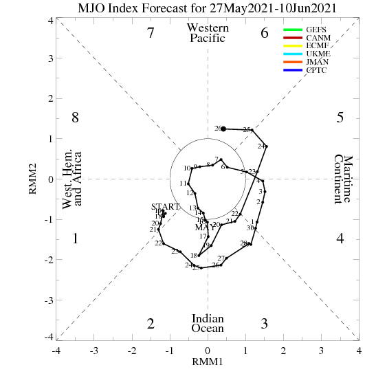
In theory another MJO event is likely initiate sometime next month and propagate east across the Pacific, but at the moment the models aren't really seeing it and are, to be frank, a total mess:

In the meantime, the CP convection associated with the SST warm anomalies in that region and extended Pacific jet (with precip anomalies extending unusually far north for an El Nino event) looks likely to bring about a pattern that drives a strong mountain torque event in about a week's time. For the purposes of this thread, the main things you need to know about that are that it brings about a considerable increase in the amplification of the pattern, and that it tends to be underestimated by the models in the mid-range (let alone longer range).
I expect that as the time draws near, the charts will start to get a whole lot more entertaining. You know - one of those 'wake up and smell the coffee' moments that we enjoy so much on this forum 
If you have any problems or queries relating to TWO you can Email
[email protected] https://twitter.com/peacockreports 2023's Homeland Extremes:
T-Max: 30.2°C 9th Sep (...!) | T-Min: -7.1°C 22nd & 23rd Jan | Wettest Day: 25.9mm 2nd Nov | Ice Days: 1 (2nd Dec -1.3°C in freezing fog)
Keep Calm and Forecast On