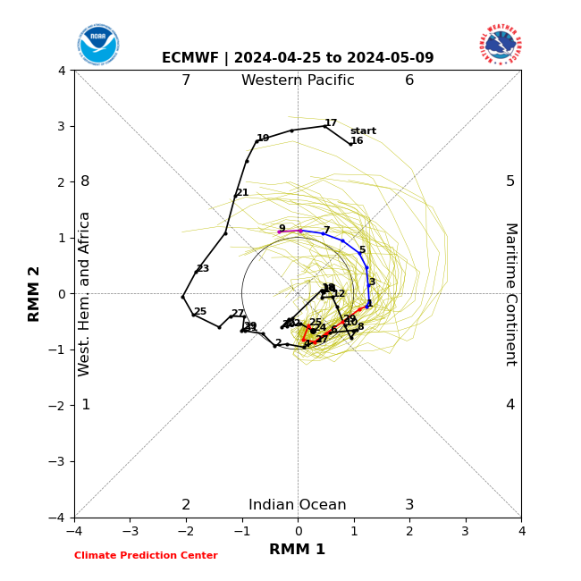
A very unusual situation in the foreseeable future, with a stalling MJO-like anomaly in the Western Pacific.
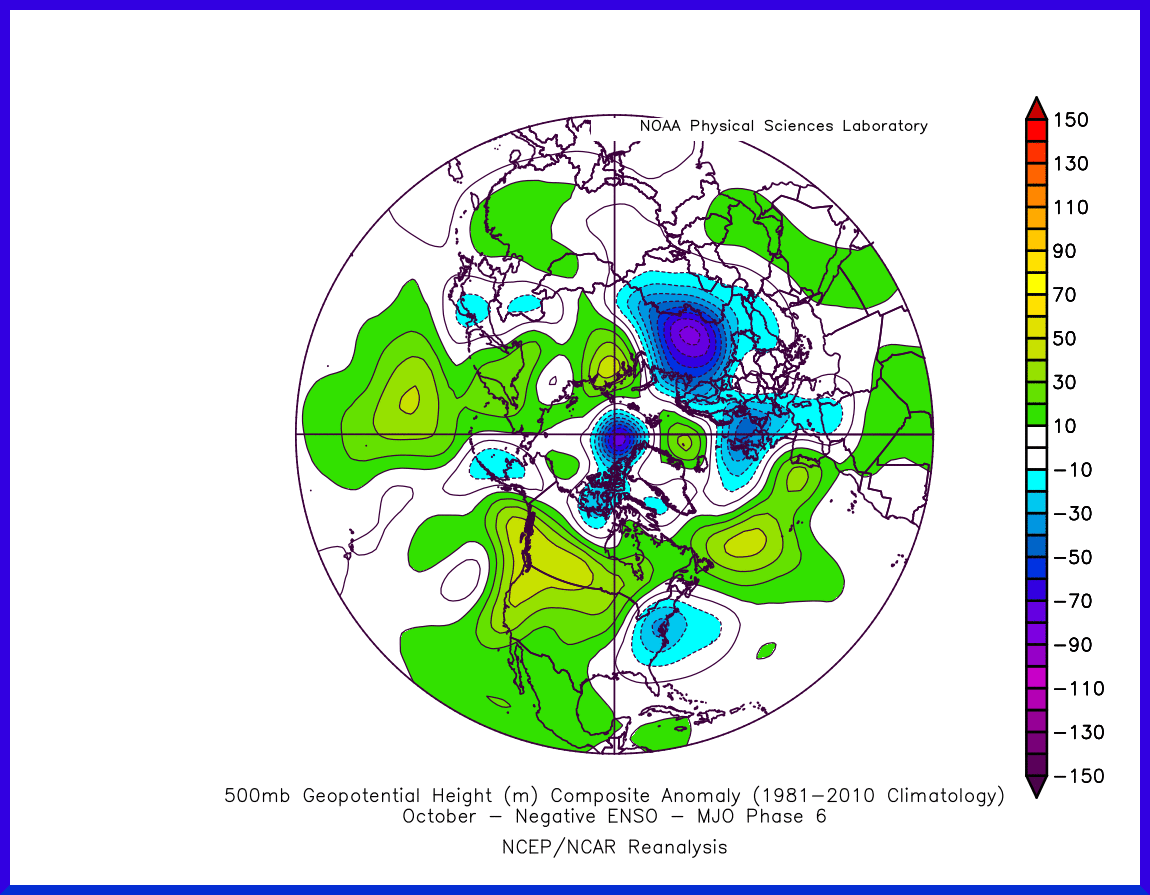
Phases 6-7 during a La Nina event such as we have now usually corresponds to a -NAO, but only phase 7 tends to be on the cold side for the UK. As it is, we're seeing phase 6 influencing the modelled response pattern for next week, though not without significant distortion.

This is typical the phase 6 Nina response pattern, unsettled for the UK with temps near average. Yet forecast modelling is predicting a large cut-off low to the southwest driving some impressively warm air across our shores for at least a few days next week.
We can see that the typical response pattern has a space to the west of Africa where a cut-off low could reside - but clearly it's not usually large or strong. Next week's outcome appears to be a 'freak event' where the mid-Atlantic ridge becomes so sharply amplified this Sun-Mon that a much larger that relatively cold air heads all the way down to the Azores and seeds a broad low there.
Signs are, the typical response pattern will attempt to reestablish by the weekend, putting the UK in a mobile setup with brisk westerlies and near normal temps - but by then the CET will have received a considerable upward boost. Starting to wonder if it could finish in the mid to high 12s. That will depend on whether we see a shift to an MJO phase 7 response pattern. The forecast models have been hinting at that in recent days, but inconsistently and tending to push any transition later in time.
If you have any problems or queries relating to TWO you can Email
[email protected] https://twitter.com/peacockreports 2023's Homeland Extremes:
T-Max: 30.2°C 9th Sep (...!) | T-Min: -7.1°C 22nd & 23rd Jan | Wettest Day: 25.9mm 2nd Nov | Ice Days: 1 (2nd Dec -1.3°C in freezing fog)
Keep Calm and Forecast On