Remove ads from site

idj20
08 September 2024 14:02:11

And finally a direct hit from one of those torrential showers here as well - peaking at 114mm/hour, and dropping 12.8mm in around 20 minutes. Most of that will have gone into ditches and drains, but it was good to see.

More rain looks to be on the way, too...

Originally Posted by: Retron 


Been only light and patchy here with 1.6 mm so far today, it's a in-your-face brisk onshore southerly wind that is being the main feature of today. Is helping to dry things out pretty quickly in between the light spitty rain showers, though.   
Folkestone Harbour. 
Stewart
08 September 2024 15:18:15
Under a moderate thunderstorm here in Southmoor, Oxfordshire. Some heavy rain. Been sailing this morning, no wind, but threatening skies sent us home
Stewart
Southmoor or Harwell, Oxfordshire
idj20
08 September 2024 16:29:52
Disregard my last post. A series of heavy showers in the past hour has bumped today's total to 17 mm so far.
Folkestone Harbour. 
Chunky Pea
08 September 2024 16:54:11

And finally a direct hit from one of those torrential showers here as well - peaking at 114mm/hour, and dropping 12.8mm in around 20 minutes. Most of that will have gone into ditches and drains, but it was good to see.

More rain looks to be on the way, too...

Originally Posted by: Retron 


Glad to see you got some thunder! ⚡ 
Current Conditions
https://t.ly/MEYqg 


"You don't have to know anything to have an opinion"
--Roger P, 12/Oct/2022
Retron
08 September 2024 17:06:47

Glad to see you got some thunder! ⚡ 

Originally Posted by: Chunky Pea 


It took long enough, didn't it? 😁

16.8mm of rain today, which is worth having. 4mm of that was proper soaking-in type rain, rather than the "straight into the gutter" type which just bounces off!

The 12-hour accumulated rainfall chart (from the radar, via NW) shows the situation well: for once Sheppey was under a broad swathe of rain (a cluster of heavy showers), whereas further north and west it was much more hit-and-miss.

https://ukwct.org.uk/weather/accum.jpg 
UserPostedImage
Leysdown, north Kent
Jiries
08 September 2024 18:57:06
Only heavy rain here this morning as it move west from the east then follow by brillant azure blue skies leaving a decent average temps day and much warmer indoors than last Friday dirty blue skies.  The clearance from the east was very striking after the rain gone that reminded me in the past storms always leaving behind decent sunny skies.  Those storms in the south was a cleaner type that cleared the skies to super blue since Friday 30th August.
ozone_aurora
08 September 2024 19:46:35
No storms in Sheffield but did have some showery rain this morning that was quite heavy at times. This was quite welcomed, as August was a dry month. It cleared away the mist and murk and there was some sunshine towards the SE in the afternoon, with quite good visibility. Obviously, the airmass changed from Tm to rPm.
Andy J
11 September 2024 15:42:37
A sudden brief thunderstorm with some very heavy hail has just gone through here.  Scattered hailstones still laying in the garden.   Some lightning and quite a few rumbles of thunder.    Storm still rumbling away as it moves SE from here.
Gainsborough, Lincolnshire.
Jiries
11 September 2024 16:35:14
Those showers today could had been snow showers if was late November to Dec at 7C below average by giving me few inches by now as showery airflow coming down here today from cheshire gap like i had in 2021 that give me 8cm each time.  
Retron
12 September 2024 17:06:38
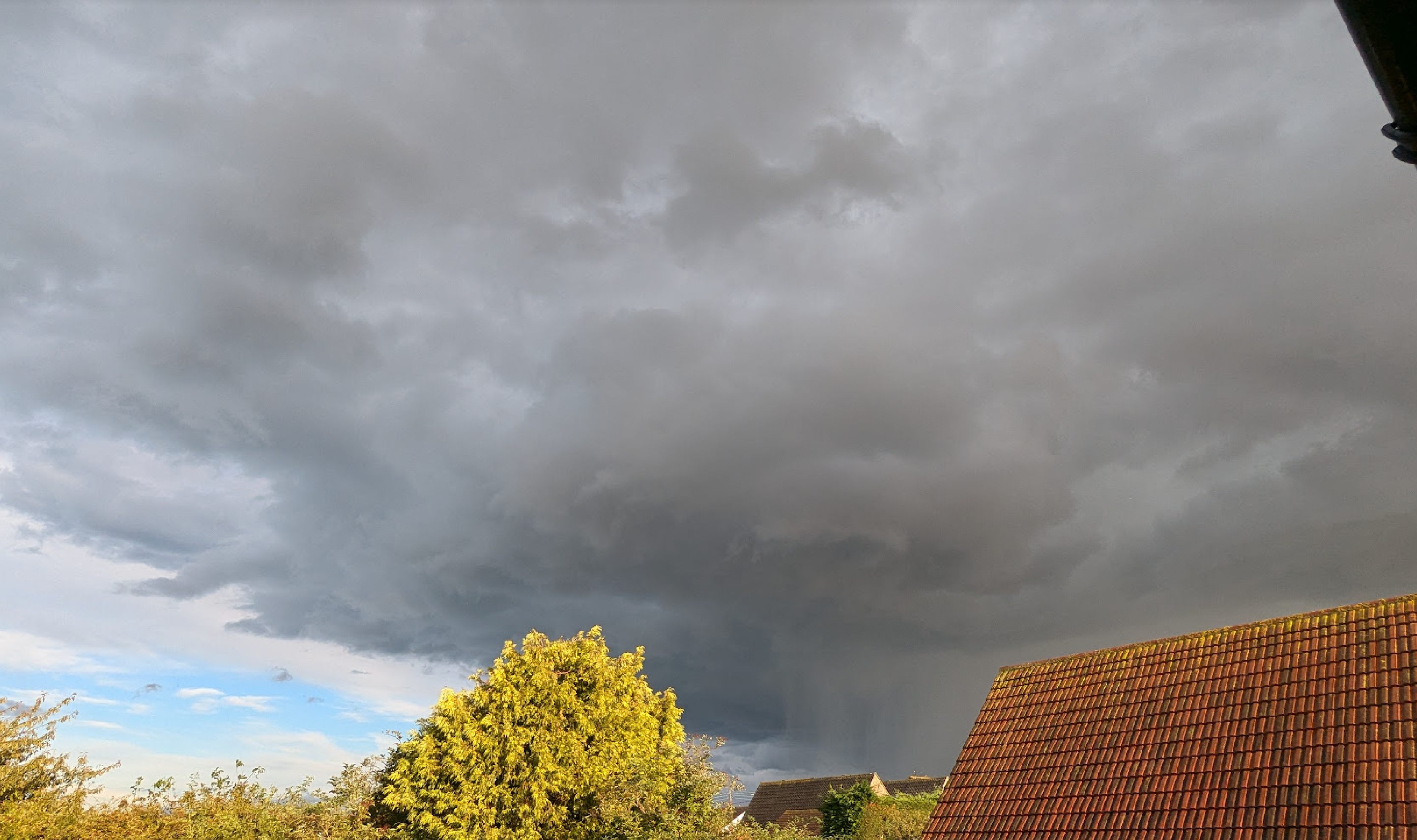
Wow, a noteworthy convective event here! Not only are there frequent rumbles of thunder (with sheet lightning) from a nearby storm, but it keeps backbuilding here - so there's sporadic heavy rainfall, even though we're on the fringe. Winds have been generally light, but there was a ferocious period of about 3 minutes when it turned into a full-blown gale! It then went back to being dead calm again.

There looked to be some rotation going on, but no sign of a funnel (thankfully).

The core is a few miles to the SE, and if you've ever seen those purples on the radar (>250mm/hour rates), well, here's what it looks like!

(Click the link and click again to see the full-size image, the rainfall is really impressive, as is the doughnut shaped ring of cloud to the left of it - I suspect that was the area of strong, gusty winds.)

https://ukwct.org.uk/weather/st.jpg 
UserPostedImage

Leysdown, north Kent
Chunky Pea
12 September 2024 19:03:14

Winds have been generally light, but there was a ferocious period of about 3 minutes when it turned into a full-blown gale! It then went back to being dead calm again.


UserPostedImage

Originally Posted by: Retron 


Base looks relatively high based too. 

That sudden pick up in wind sounds like downdraft from the storm, which likely is helping feed those back builds you speak off. 
Current Conditions
https://t.ly/MEYqg 


"You don't have to know anything to have an opinion"
--Roger P, 12/Oct/2022
StoneCroze
19 September 2024 11:49:56
Thunderstorm warnings issued!!
Yellow warning of thunderstorms
Areas affected: East Midlands | East of England | London & South East England | South West England | Wales | West Midlands

Starts: 12:00 BST on Fri 20 SeptemberEnds: 20:00 BST on Fri 20 September
While many places will remain dry, thunderstorms and heavy showers could cause some disruption on Friday in a few places.

- Probably some damage to a few buildings and structures from lightning strikes
- Some short term loss of power and other services is likely
- Delays to train services are possible
- Driving conditions may be affected by spray, standing water and/or hail, leading to longer journey times by car and bus

Issued at: 09:37 BST on Thu 19 September

Alderney, Channel Islands. (previously known as Beaufort)
Matty H
19 September 2024 16:53:36
Two TS warning issued for parts of England and Wales for tomorrow and again Friday night into Saturday. 
DEW
  • DEW
  • Advanced Member
19 September 2024 17:16:01
Meto rainfall forecast for the south has gone all technicolour

https://www.metoffice.gov.uk/weather/maps-and-charts/rainfall-radar-forecast-map#?model=ukmo-ukv&layer=rainfall-rate&bbox= [[48.60435761723107,-13.974588997275635],[54.50876550586147,5.76784264334939]]

War does not determine who is right, only who is left - Bertrand Russell

Chichester 12m asl
Brian Gaze
19 September 2024 20:15:05
CAPE values remain quite high through tomorrow and the weekend. Looks like there could be quite a lot of action.


UserPostedImage
Brian Gaze
Berkhamsted
TWO Buzz - get the latest news and views 
"I'm not socialist, I know that. I don't believe in sharing my money." - Gary Numan
Roger Parsons
19 September 2024 20:17:53

A sudden brief thunderstorm with some very heavy hail has just gone through here.  Scattered hailstones still laying in the garden.   Some lightning and quite a few rumbles of thunder.    Storm still rumbling away as it moves SE from here.

Originally Posted by: Andy J 


How very annoying, Andy!!!! We've had a gloomy uneventful grey day here near Lincoln.
RogerP
West Lindsey district of Lincolnshire
Everything taken together, here in Lincolnshire are more good things than man could have had the conscience to ask.
William Cobbett, in his Rural Rides - c.1830
ozone_aurora
19 September 2024 20:21:21
The metoffice forecast is for heavy rain and showers including thunder over East of England over the weekend, but, for Yorkshire & Humber, dry with a lot of low cloud but also occasional sunshine - no sign of any rain or showers. The northernmost boundary of rain must be very sharply defined along the regional forecast border, unless one of the forecasts are wrong. ?( 
warrenb
20 September 2024 08:22:10
Rumbles of thunder being heard here at the moment
MRazzell
20 September 2024 09:52:51
I'm not sure how to post photos on here (needs a URL?!), but the rainfall, thunder and hail that has just passed over here in East Sussex is unlike anything i've ever experienced. The hailstones alone are the size of marbles. 
Matt.
POD
  • POD
  • Advanced Member
20 September 2024 10:06:49
Over two inches recorded at a PWS in Crowborough.  Here at Crawley Down, large hail, lightning and thunder 164.7mm/hr max.  24.0mm
Pat, Crawley Down, West Sussex.
NMA
  • NMA
  • Advanced Member
20 September 2024 10:40:09
The radar certainly looks interesting. Convection wise.

Just looked out of the office and a few minutes ago a Supermarine Spitfire went overhead. I think that's what it is.

https://photo-serve.planefinder.net/remote/lh3.googleusercontent.com/3Q40qwt1QoYxj_Dp9pkCQZKIPlGahVCPTfNT1oZpcEM-MTjDMf_8iM0EbtCTGFQeqZHpFP3h32zNUNQnu-wGokXdveWQaN-QCeD8=s400 

Seems to a a training day ancient and modern looking at live flights...


Vale of the Great Dairies
South Dorset
Elevation 60m 197ft
NMA
  • NMA
  • Advanced Member
20 September 2024 11:24:04
That storm seems to have disrupted Gatwick airport with flights either kept on the ground or placed into holding patterns away from danger as the storm passed over. It seems to be trundling majestically westwards.
Vale of the Great Dairies
South Dorset
Elevation 60m 197ft
Retron
20 September 2024 11:36:11

I'm not sure how to post photos on here (needs a URL?!), but the rainfall, thunder and hail that has just passed over here in East Sussex is unlike anything i've ever experienced. The hailstones alone are the size of marbles. 

Originally Posted by: MRazzell 


For "fire and forget" hosting you can just use Postimg - upload an image and it'll give you a URL to paste in here.

https://postimages.org/ 

You'll want to use the "direct link" URL, .e.g.

https://i.postimg.cc/JhBB2WPc/radar.jpg 

UserPostedImage

(That's the radar and lightning detection via NetWeather as of 10:45 this morning, quite an active storm!)
Leysdown, north Kent
20 September 2024 11:56:22
Missed that storm due to travelling to London for a rare office visit. Knew it was approaching so was glad not to be caught in it on my way to the station. My eldest sent a video of the dramatic black clouds with lightning flashing through the heavy rain. Also a photo of mammatus clouds as it moved away. 
Shame I missed it. Been a good month for thunderstorms in East Surrey

Jason
Salfords, Surrey
tierradelfuego
20 September 2024 11:56:23
Good storm here now, frequent lightning and thunder less than a mile away, top rainfall rate so far is 140mm/hr

Looks like 30 mins of it or so
Bucklebury
West Berkshire Downs AONB
135m ASL

VP2 with daytime FARS
Rainfall collector separated at ground level
Anemometer separated above roof level
WeatherLink Live (Byles Green Weather)

Remove ads from site

Ads