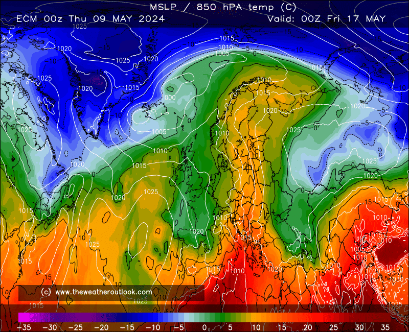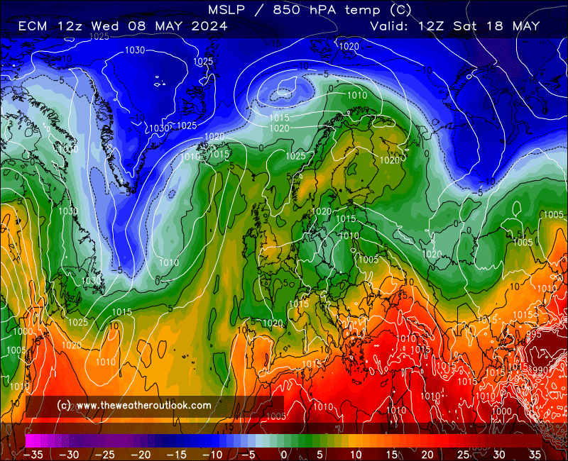

The curious alliance of UKMO and GEM continues this morning. These two are suggesting that a wall of HP to the east will utter a cry of 'you shall not pass!' to the deep low and prevent it from pushing east of the UK, let alone right over into Scandi as per the 00z ECM and GFS runs.


These two outcomes are almost complete opposites to one another 


GEM becomes interesting days 9-10 as the plume that's never been cleared away finds its way back toward the UK. Quite the contrast to ECM's cool but fairly settled ideas (not entirely though; cold enough air aloft and a weak enough ridge for showers to develop in places).
The GEM solution is more fitting with the tendency of recent summers for blocking highs over Scandi to be more frequent and strong than usual, but this year so far has stood out greatly in having predominantly low pressure and temps... but then again, Tue-Wed sees a major influx of warm air there which could well change the balance of play toward subsidence from aloft. A pivotal moment coming up or just a wobble, I wonder? 
Originally Posted by: Stormchaser