Remove ads from site

Sevendust
12 June 2017 23:04:37
ECM looks a tad steamy out to the mid-term
Ally Pally Snowman
13 June 2017 07:09:15

Some serious heat from the latest ecm 18c 850s in a week's time.


http://old.wetterzentrale.de/pics/Recm1202.html


http://old.wetterzentrale.de/pics/Recm1682.html


Bishop's Stortford 85m ASL.
Gavin D
13 June 2017 07:10:22
Very warm to hot from ECM this morning from t144 onwards easily into the 30s at times Midlands South
Ally Pally Snowman
13 June 2017 07:11:19

WOW! 21c 850s into Kent!


http://old.wetterzentrale.de/pics/Recm2402.html


Bishop's Stortford 85m ASL.
Gavin D
13 June 2017 09:59:20

UKMO extended (t168)


Hungry Tiger
13 June 2017 10:28:56


WOW! 21c 850s into Kent!


http://old.wetterzentrale.de/pics/Recm2402.html


Originally Posted by: Ally Pally Snowman 


Phew - what sort of temperatures would we see from that.


Gavin S. FRmetS.
TWO Moderator.
Contact the TWO team - [email protected]
South Cambridgeshire. 93 metres or 302.25 feet ASL.


Hungry Tiger
13 June 2017 10:33:14


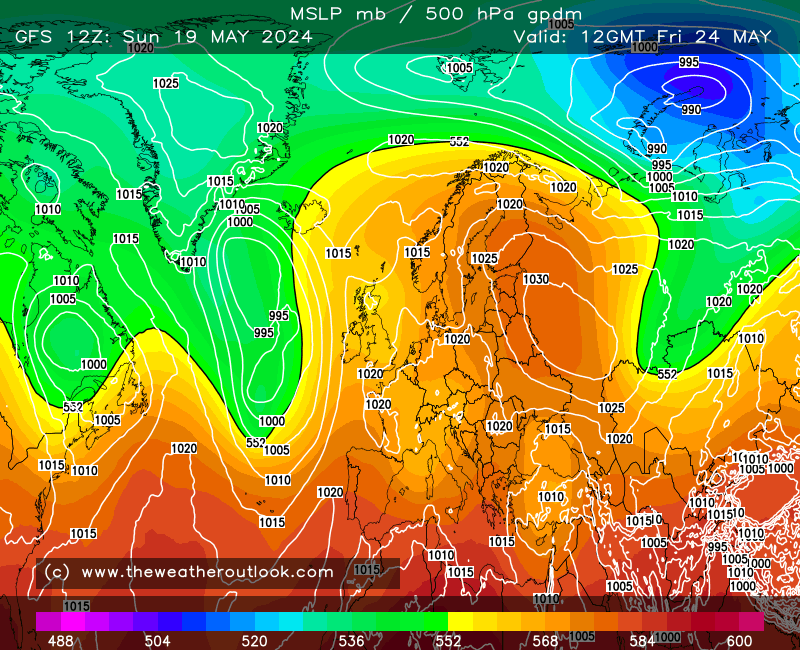
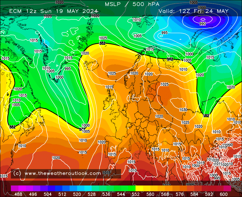
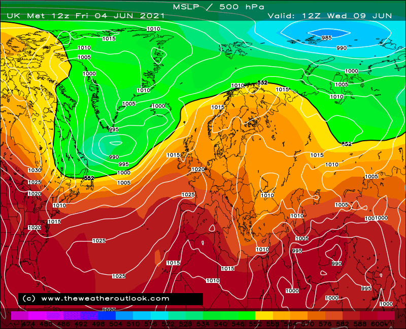
At day 5 we see where GFS (upper-left) goes wrong (I prefer to go with this terminology when speaking of GFS... ha); the Atlantic jet is flatter (the thick black line can be a loose guide here - note how it runs closer to W-E rather than SW-NE) and so a trailing front down west of the Azores is unable to remain intact, splitting apart with a shallow low becoming cut-off just west of the Azores (the loop of 1020 mb isobar). 


ECM, GEM and UKMO all align the jet more SW-NE with the trailing front staying intact, at least until a day or so later in time. This is enough that the strong ridge from the Azores would find it harder to retract west, and in any case the different jet alignment puts the low passing by Iceland on a trajectory more to the E or NE as opposed to being able to turn quite sharply SE as GFS goes with.


So the majority vote is for the ridge to drift slowly east instead, with the ECM 12z illustrating this very nicely for days 6-7;
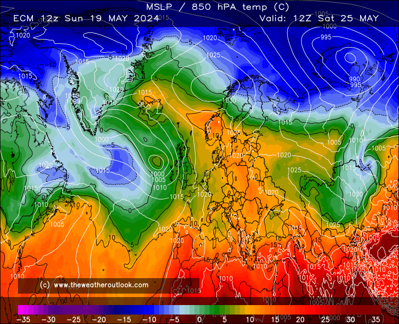
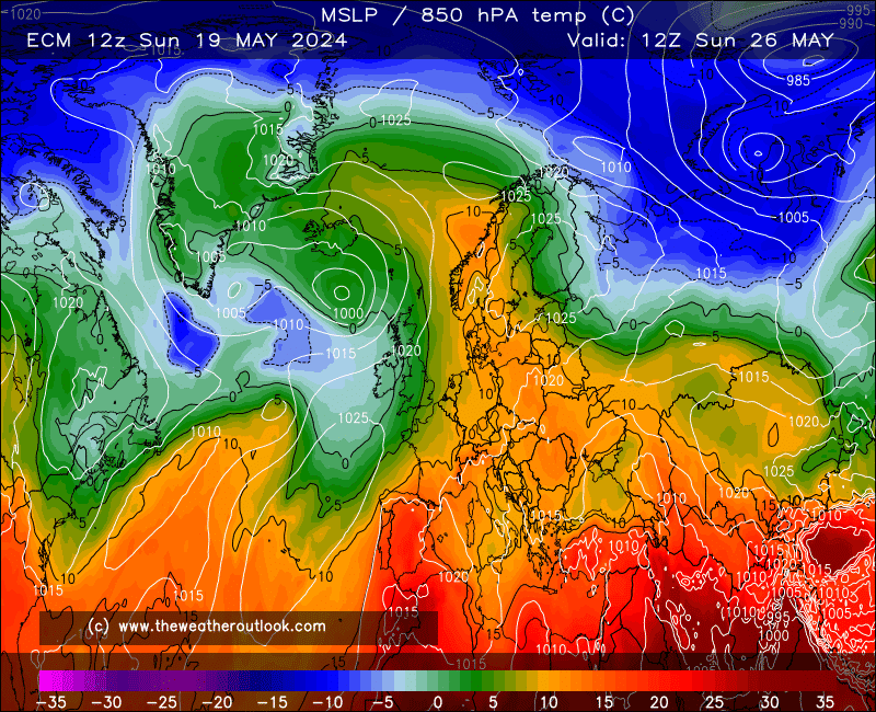


This is very similar indeed to GEM, while UKMO is a little more clunky as the jet does not retain as much SW-NE orientation so LP passes rather close to the N, but the trailing front does its job to prevent the ridge going west, and the low heading for Scandinavia loses most of its strength before it gets there, such that it's unable to directly drive any cooler air across the UK.


The ECM 12z then goes a little tricky in terms of the evolution; the bubble of HP scooting across is not something I can recall seeing very often;
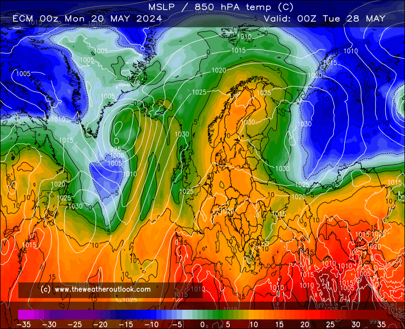
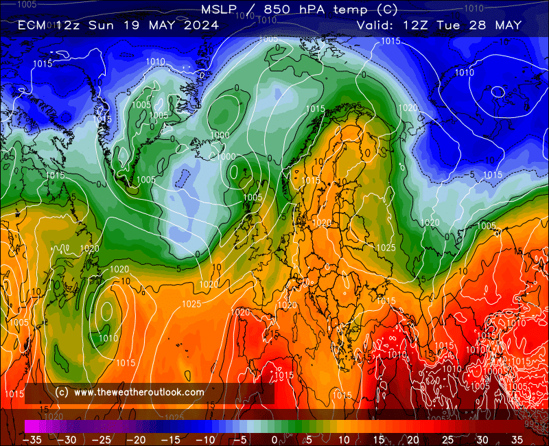


It;s a neat trick for the south but not so for the north where the polar boundary could produce some spells of rain. Too far ahead to worry about such details though, and for all we know GEM is still leading the way with its dramatic take on events;


This has changed from the past two runs in that it breaks things down a little faster and before the dangerous levels of heat have really managed to establish themselves, but the thunderstorm potential with this is pretty serious. I'd personally be happier with the ECM 12z run but for northerners' sake a stronger ridge to the north of the plume is kindly requested .


Originally Posted by: Stormchaser 


Great post James and thanks for your excellent informative descriptions.


Gavin S. FRmetS.
TWO Moderator.
Contact the TWO team - [email protected]
South Cambridgeshire. 93 metres or 302.25 feet ASL.


Ally Pally Snowman
13 June 2017 10:43:47


Phew - what sort of temperatures would we see from that.


Originally Posted by: Hungry Tiger 


I think its a long shot but if it did come off we'd be looking at mid 30s possible June record territory. 


Bishop's Stortford 85m ASL.
Ally Pally Snowman
13 June 2017 10:51:00

Big step towards the ecm from the gfs 6z. Not as extreme mind.


Bishop's Stortford 85m ASL.
Stormchaser
13 June 2017 11:15:48

While the model war continues (and boy is UKMO annoying with it's sort-of-GFS-like-but-flatter-ridge-so-could-push-east-again-but-can't-really-tell day 7 chart), the CFS mean for June is as much use as anything, and worth a gander as it's a quite dramatic one;


This is a total flip from the previous set of runs though so, you know, it's CFS 


Anyway, it's rare that ECM gets it much wrong at just 5 days range but as they say, if there's ever going to be a time... 


Generally though I still see the typical spread of progressiveness of the trough/flatness of the jet defining the weekend outcomes, with ECM slowest, GFS fastest, and UKMO somewhere in between.


Mash it all together and most of England and Wales sees a very fine weekend while the longer-term has reasonable scope for reloads should things turn fresher by Tuesday (Monday up north, and much fresher indeed in the case of GFS). Those up in Scotland and perhaps far-N. England will have to hope ECM is at least something like 80% right though.


If you have any problems or queries relating to TWO you can Email [email protected]

https://twitter.com/peacockreports 
2023's Homeland Extremes:
T-Max: 30.2°C 9th Sep (...!) | T-Min: -7.1°C 22nd & 23rd Jan | Wettest Day: 25.9mm 2nd Nov | Ice Days: 1 (2nd Dec -1.3°C in freezing fog)
Keep Calm and Forecast On
Jiries
13 June 2017 11:28:50


I think its a long shot but if it did come off we'd be looking at mid 30s possible June record territory. 


Originally Posted by: Ally Pally Snowman 


Just near bang on to the longest day so maybe 35-37C possible.  Anyway what ever is we will see some +30C days to come.

Gusty
13 June 2017 11:48:57

Increased confidence today for a heatwave, of potentially some note for some next week as the 20c 850Hpa starts to show its hand close to the south on a few perturbations.


Interesting times ahead. 


Steve - Folkestone, Kent
Current conditions from my Davis Vantage Vue
https://www.wunderground.com/dashboard/pws/IFOLKE11 
Join Kent Weather on Facebook.
https://www.facebook.com/stevewall69/ 


Solar Cycles
13 June 2017 13:59:50


While the model war continues (and boy is UKMO annoying with it's sort-of-GFS-like-but-flatter-ridge-so-could-push-east-again-but-can't-really-tell day 7 chart), the CFS mean for June is as much use as anything, and worth a gander as it's a quite dramatic one;


This is a total flip from the previous set of runs though so, you know, it's CFS 


Anyway, it's rare that ECM gets it much wrong at just 5 days range but as they say, if there's ever going to be a time... 


Generally though I still see the typical spread of progressiveness of the trough/flatness of the jet defining the weekend outcomes, with ECM slowest, GFS fastest, and UKMO somewhere in between.


Mash it all together and most of England and Wales sees a very fine weekend while the longer-term has reasonable scope for reloads should things turn fresher by Tuesday (Monday up north, and much fresher indeed in the case of GFS). Those up in Scotland and perhaps far-N. England will have to hope ECM is at least something like 80% right though.


Originally Posted by: Stormchaser 

The ECM wasn't all,that good in the 5 day range last winter SC, for what it's worth I see a fairly average outlook with some warm dry weather interspersed with cool wet ones over the next 7-14+ days. Nothing untoward lurking in the cupboard with some very useable weather.

Stormchaser
13 June 2017 15:03:19

ECM produces 28-30*C by Tuesday which is a week away, and about the same time that GFS turns things cooler.


Given the strong low-GLAAM bias of GFS/GEFS which translates to a tendency for ridges to retreat west too often and too far (false teases of wintertime northerlies are one of the most infamous examples!), one could say GFS is more likely to back down than ECM, but unfortunately exceptions can and do happen, therefore we can only see the warmer outcome as the more likely but far from guaranteed.


UKMO can be the decider when trying to place probabilities at times like this, but the past few runs have been leaning first one way then the other, so it's not proving to be of much help at the moment. Historically I have seen it move large-scale troughs too quickly, a bit like GFS often does but not to such an extreme, but I've also seen it hold blocking highs in place for too long as well - it really is a mysterious model!


12z runs start rolling out within the next hour... nervous times if you're among those looking for summer warmth to continue in the south next week while ideally extending to northern regions at the same time.


If you have any problems or queries relating to TWO you can Email [email protected]

https://twitter.com/peacockreports 
2023's Homeland Extremes:
T-Max: 30.2°C 9th Sep (...!) | T-Min: -7.1°C 22nd & 23rd Jan | Wettest Day: 25.9mm 2nd Nov | Ice Days: 1 (2nd Dec -1.3°C in freezing fog)
Keep Calm and Forecast On
moomin75
13 June 2017 16:50:32
GFS is still having none of it. Dry and mildish but nothing hot or even very warm.
Something will have to give soon and my guess is ECM will back down as GFS has been consistently modelling this cooler version of summer.
Witney, Oxfordshire
100m ASL
Arcus
13 June 2017 17:01:56
Ally Pally Snowman
13 June 2017 18:44:01

Heat still there on the ecm 17/18c 850s . What's the June record could be under threat?


http://old.wetterzentrale.de/pics/Recm1442.html


Bishop's Stortford 85m ASL.
picturesareme
13 June 2017 18:48:26


Heat still there on the ecm 17/18c 850s . What's the June record could be under threat?


http://old.wetterzentrale.de/pics/Recm1442.html


Originally Posted by: Ally Pally Snowman 


35.6C / 96.1F


Southampton back in June 1976

Ally Pally Snowman
13 June 2017 18:54:22


35.6C / 96.1F


Southampton back in June 1976


Originally Posted by: picturesareme 


Thanks for that. Will be tough but u never know.


Bishop's Stortford 85m ASL.
Ally Pally Snowman
13 June 2017 18:59:16

Ecm goes all gfs after day 6 though . Very different  to the 0z.


Bishop's Stortford 85m ASL.
moomin75
13 June 2017 19:00:47


Ecm goes all gfs after day 6 though . Very different  to the 0z.


Originally Posted by: Ally Pally Snowman 

As expected by some on here. Nothing is certain but the more changeable ECM backing towards GFS remains more likely in my view. I think the weekend is looking very decent for most but at the current time it looks like a short lived burst of warmth before a return to temps in the high teens and shower weather.


Witney, Oxfordshire
100m ASL
Ally Pally Snowman
13 June 2017 19:15:14


As expected by some on here. Nothing is certain but the more changeable ECM backing towards GFS remains more likely in my view. I think the weekend is looking very decent for most but at the current time it looks like a short lived burst of warmth before a return to temps in the high teens and shower weather.


Originally Posted by: moomin75 


Could well be , but there is so much heat to our south at the moment any type of southerly will be a very warm or hot one this summer. 


Bishop's Stortford 85m ASL.
LA2B MeridFlowEuro09
13 June 2017 19:18:34

I can see a forthcoming in the short to mid range a four day heatwave, shown from Friday to Monday- backed by in general a Thundery Low from Spain and Bay of Biscay, and that northwest UK bound Developing Short wave trof then Low Pressure, today's 12z ECMWF really out on it's own but I can see that the UKMO looks like being closest to the outcome for T144 Monday 19th June.


The GFS tracking Low's over the North and NW UK then push down the eastern side with Pressure higher SW UK half at same time if GFS is to be believed - this does not look like what today's ECMWF is on about- it supports a freak SW UK far W and then the NW UK being on the receiving end of a Cool Low Pressure that is supporting UKMO's suggestion that on Monday first half of day should be very warm away from the West and NW far side UK.


And beyond that for next week there could be further rebuilding of High Pressure from SW Europe Azores high, with North Atlantic and NW Atlantic recurving Jetstream Flows and Waves of Low Pressure weaken as it comes closer to our West and North- we should be seeing some NW SE divide in our weather with NW side Low Pressure, with more cloudy wet weather possible but over the Eastern and Central to South UK High Pressure should bring slightly or moderately above average temperatures especially farther SE S and in Central UK.


The GFS and ECMWF as well as the UKMO will need further re analysis and checking for the 72-120 hour range and the T144's today are making me feel very excited for possible West NW France SW UK Thundery showers, Ideally I mean I wish to see them in east London but I do not mind if all of Monday the warm hot and sunny cloudless weather stays put instead- maybe it is turn for the west and NW UK to receive them which they have received many times already in the last 4 weeks.  The GFS is out on it's own at T144, so they should fix it.


I have seen plenty of heavy Thundery showers this year in this month of June anyway!.😆🌞😉⛈😅😎🌞🌤.


Ps. Note if James aka Stormchaser reads this - Just edited another part about the 12z GFS for Monday to Tuesday next week because it goes different take.


Climate is warming up, Scotland and N Ireland and North England still often gets some Winter frost, ice and snow, November to March, but the SE and South UK including S Central England and Wales, together with the West and North through the year, they sometimes get more rain than London and S SE England, where some longer dry fine spells without much heavy rain is seen every year.

The North Atlantic Sea often gets some much Colder Wintry conditions from November to March Months, and Mild SW and South winds tend to be more frequent over the East and SE of North Atlantic Sea, as the Azores High tends to stay in charge. 

With this warmth and heat, the Central and South UK has become mostly free of snow and frost.
moomin75
13 June 2017 19:24:39


Could well be , but there is so much heat to our south at the moment any type of southerly will be a very warm or hot one this summer. 


Originally Posted by: Ally Pally Snowman 

That's my hunch too. I am thinking warm and thundery summer. I never expect to see great heat in June. July and August though could prove very interesting this year as the heat directly to our South is exceptional for so early in the summer.


Witney, Oxfordshire
100m ASL
LA2B MeridFlowEuro09
13 June 2017 19:30:34


That's my hunch too. I am thinking warm and thundery summer. I never expect to see great heat in June. July and August though could prove very interesting this year as the heat directly to our South is exceptional for so early in the summer.


Originally Posted by: moomin75 


No Moomin, it looks like some of that very clear and sunny Continental heat is expected to affect us later this Friday and the Weekend and on Monday as well for those of us in the S C SE parts of the UK, with this very light winds and wall to wall sunshine being shown by ECMWF and the UKMO at 96-120-144, but the GFS does not for the Monday ahem.


Climate is warming up, Scotland and N Ireland and North England still often gets some Winter frost, ice and snow, November to March, but the SE and South UK including S Central England and Wales, together with the West and North through the year, they sometimes get more rain than London and S SE England, where some longer dry fine spells without much heavy rain is seen every year.

The North Atlantic Sea often gets some much Colder Wintry conditions from November to March Months, and Mild SW and South winds tend to be more frequent over the East and SE of North Atlantic Sea, as the Azores High tends to stay in charge. 

With this warmth and heat, the Central and South UK has become mostly free of snow and frost.

Remove ads from site

Ads