Remove ads from site

Argyle77
25 November 2019 16:26:00

Turning dryer and frosty for the weekend and perhaps next week too,high pressure looks like sitting over the top of us,and very cold uppers arriving ,look unlikely now.


Certain won’t be seeing minus 10 850 hpa.


Looking forward to some dry weather

Might  be able to get back on the golf course 🏌️‍♂️

idj20
25 November 2019 16:34:22

If we can't have a Dec '10 style start to this winter, a week of usable mild, dry and bright weather would do me fine. Would be welcome after what has been (and still is) a wetter than average November for this neck of the wood. 

The snow hoping part can wait until January at the earliest - and even then have to keep expectations low. 


Folkestone Harbour. 
Brian Gaze
25 November 2019 16:37:32

GFS 12z obviously hasn't seen the UK Met's monthly forecast. Goodness me.


Brian Gaze
Berkhamsted
TWO Buzz - get the latest news and views 
"I'm not socialist, I know that. I don't believe in sharing my money." - Gary Numan
doctormog
25 November 2019 17:14:24
It looks like a consensus is growing (from the GFS op runs at least) that we will have unsettled conditions until around Thursday then cooler conditions for 4 or 5 days then more mobile and often milder conditions from around the 2nd of December.

The UKMO 12z covers the middle but so looks cool and quite settled throughout.
Gandalf The White
25 November 2019 17:29:18

It looks like a consensus is growing (from the GFS op runs at least) that we will have unsettled conditions until around Thursday then cooler conditions for 4 or 5 days then more mobile and often milder conditions from around the 2nd of December.

The UKMO 12z covers the middle but so looks cool and quite settled throughout.

Originally Posted by: doctormog 


Yes, a period of rather cold weather then briefly settled then more zonal but with marked temperature swings as cold fronts sweep through.


Not suggesting for a moment a repeat of that famous winter, but merely to demonstrate that the pattern can change very suddenly, here's an almost identical pattern from the second week of December 1962 - 12th December that year compared with December 9th in the latest GFS forecast chart.   


L


Location: South Cambridgeshire
130 metres ASL
52.0N 0.1E


Rob K
25 November 2019 17:38:12
I've been away from the models for a couple of days but I'm a bit puzzled by the talk of an upcoming cold spell. I ca't see much sign of one on any models, unless you count three or four days of -5C 850s under highish pressure a cold spell, which I'm not sure I do...
Yateley, NE Hampshire, 73m asl
"But who wants to be foretold the weather? It is bad enough when it comes, without our having the misery of knowing about it beforehand." — Jerome K. Jerome
doctormog
25 November 2019 17:49:29

I've been away from the models for a couple of days but I'm a bit puzzled by the talk of an upcoming cold spell. I ca't see much sign of one on any models, unless you count three or four days of -5C 850s under highish pressure a cold spell, which I'm not sure I do...

Originally Posted by: Rob K 


To be fair there is not that much talk of a cold spell either.


Gandalf The White
25 November 2019 17:58:32

I've been away from the models for a couple of days but I'm a bit puzzled by the talk of an upcoming cold spell. I ca't see much sign of one on any models, unless you count three or four days of -5C 850s under highish pressure a cold spell, which I'm not sure I do...

Originally Posted by: Rob K 


2m maxima for the five days starting Friday for East Anglia, per the latest GFS run:


5, 5, 3, 4, 5   


Obviously much colder further north with some ice days and some scattered wintry showers for north and east facing coasts for a couple of days.


By any definition that counts as five days of cold weather.  But I don't think anybody has predicted anything unusual for this time of year.


Location: South Cambridgeshire
130 metres ASL
52.0N 0.1E


Shropshire
25 November 2019 18:00:13

I've been away from the models for a couple of days but I'm a bit puzzled by the talk of an upcoming cold spell. I ca't see much sign of one on any models, unless you count three or four days of -5C 850s under highish pressure a cold spell, which I'm not sure I do...

Originally Posted by: Rob K 


Yes agreed, the chilly days are soon replaced by the Azores High ridging in. Hard to see what the METO are talking about in terms of cold weather and strong winds next week.


From December 27th 2020, zonality will be banned from mixing with the UK. We appreciate that this may come as a shock to younger people and old Uncle Barty. This ban will last for a minimum of ten days.
Brian Gaze
25 November 2019 18:00:59


I've been away from the models for a couple of days but I'm a bit puzzled by the talk of an upcoming cold spell. I ca't see much sign of one on any models, unless you count three or four days of -5C 850s under highish pressure a cold spell, which I'm not sure I do...


Originally Posted by: Rob K 


The Met O is more bullish about it. Take a look at their current 30 dayer. 


Brian Gaze
Berkhamsted
TWO Buzz - get the latest news and views 
"I'm not socialist, I know that. I don't believe in sharing my money." - Gary Numan
Argyle77
25 November 2019 18:08:10
lots of colder runs on the gfs ensembles,the op run,went pretty mild rather quickly,the reality could be much different .
doctormog
25 November 2019 18:13:16

lots of colder runs on the gfs ensembles,the op run,went pretty mild rather quickly,the reality could be much different .

Originally Posted by: Argyle77 


Yes, I would not be surprised to see the cooler and more settled weather last an extra couple of days before more mobile conditions move in. There is still some uncertainty post December the 2nd. 


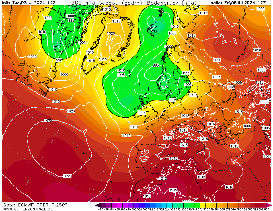
I wonder what the later stages of the ECM 12z will show. This is the 72hr chart 


Hippydave
25 November 2019 18:27:18

Could just be my wonky memory but the GFS Op's pattern of Northerly topplers seems to be one it throws out fairly regularly for the 1st part of December. I seem to remember one of my as usual poor CET guesses for last December or possibly the year before was based on a repeating pattern of shortish, sharpish colder spells as HP ridged North from the Atlantic. Needless to say that didn't verify well and after the first Northerly the pattern changed. 


Seems to me it's a model thing in response to changing temperature profiles as it often shows up but rarely carries on for as long as it's shown to <shrug>


Home: Tunbridge Wells
Work: Tonbridge
Bertwhistle
25 November 2019 18:39:26


Yes, I would not be surprised to see the cooler and more settled weather last an extra couple of days before more mobile conditions move in. There is still some uncertainty post December the 2nd. 


I wonder what the later stages of the ECM 12z will show. This is the 72hr chart 


Originally Posted by: doctormog 


I agree- particularly, but not necessarily exclusively, in the N.


The chart posted here Doc is interesting as the trough extending to the W of Ireland has a notable kink in it shaped by the higher pressure over Iceland. If those isobars had been drawn NW or even NNW SSE, I would (can't say why) expect an easy passage for that next low. But this set up implies a SEly on the straight edge of that next low. Unless there's a complete collapse of heights over the Iceland region, I reckon there could be a series of sinking lows under an increasingly cold N/NEly stream over N Uk. 


Conjecture, of course.


Bertie, Itchen Valley.
Retire while you can still press the 'retire now' button.
ballamar
25 November 2019 18:47:27
Almost a good ECM chart, the link between highs tantalisingly close
Hippydave
25 November 2019 19:16:02

ECM and GFS (Ops) seem to be singing from a very similar hymn sheet to my eyes - some wet stuff over next few days followed by some quieter colder weather before the HP ridge topples and milder air returns over the top. Our HP then links with another cell coming out of the states setting up another brief northerly.


With a little more northward ridging on the 2nd attempt that could be more interesting than the 1st go.


It's obviously not a bone chilling outlook but seasonal at least.


Home: Tunbridge Wells
Work: Tonbridge
Steve Murr
25 November 2019 19:22:00
Evening All

Things settling down in the model world after the weekend excitement -

No phase 2 cold as the vertical advection has been replaced by something a little more positive ( tilt ) That said still a 4-5 day cold snap to usher Winter in however post that nothing zonal bar 36-48 hours as the next phase of amplification looks to send a vortex lobe SE towards the UK.

Enjoyable times model viewing with no sign of the much touted 'zonal / zonaity' on the entry to December.

I wonder actually how many southwesterly days there have been ! Not many.
DPower
25 November 2019 19:24:51

Well that didn't take long to implode, uppers away from Scotland and the far north generally around -5c so rather cold with some sharp overnight frosts typical early winter fair. At least the strat warming is  forecast to become a lot stronger again in fi but can it be trusted.

Bertwhistle
25 November 2019 19:30:08

Nothing for everybody to complain about- keep quoting 'standard fare' as if it's a loser. Lovely pre-seasonal twist to get you in the mood for the next season, then uncertainty. What's not to like?


Bertie, Itchen Valley.
Retire while you can still press the 'retire now' button.
Shropshire
25 November 2019 19:31:20

Evening All

Things settling down in the model world after the weekend excitement -

No phase 2 cold as the vertical advection has been replaced by something a little more positive ( tilt ) That said still a 4-5 day cold snap to usher Winter in however post that nothing zonal bar 36-48 hours as the next phase of amplification looks to send a vortex lobe SE towards the UK.

Enjoyable times model viewing with no sign of the much touted 'zonal / zonaity' on the entry to December.

I wonder actually how many southwesterly days there have been ! Not many.

Originally Posted by: Steve Murr 


I disagree Steve, the direction of travel is the jet coming over the High and we know that usually means a sinker. The best bet is for it to pull back West to allow further Northerly shots.


From December 27th 2020, zonality will be banned from mixing with the UK. We appreciate that this may come as a shock to younger people and old Uncle Barty. This ban will last for a minimum of ten days.
Steve Murr
25 November 2019 19:45:55


I disagree Steve, the direction of travel is the jet coming over the High and we know that usually means a sinker. The best bet is for it to pull back West to allow further Northerly shots.


Originally Posted by: Shropshire 


Yes thats what I was referring to - if you look at the flow on ECM the day 9 into 10 & 10 into 11 these are the only zonal ish days before the model suggest a sharp gradient to the NW 👍🏼

Gandalf The White
25 November 2019 19:48:03


Well that didn't take long to implode, uppers away from Scotland and the far north generally around -5c so rather cold with some sharp overnight frosts typical early winter fair. At least the strat warming is  forecast to become a lot stronger again in fi but can it be trusted.


Originally Posted by: DPower 


Eh? What's supposed to have 'imploded'? The charts have firmed up on pretty much what they were showing, i.e. 4-5 days of rather cold weather before a recovery in temperatures and a return of a period of zonality.  I don't think anyone was seriously predicting sustained cold and snow.


The question is for how long we might see zonality with mostly mild conditions given there are hints of another plunge of cold air that have been evident in recent GFS runs and now tonight in the ECM at day 10 (with the usual caveats at that range).


Location: South Cambridgeshire
130 metres ASL
52.0N 0.1E


Brian Gaze
25 November 2019 20:36:22

A 4 to 5 day event doesn't fit in with the Met O forecast at all. Their current update talks about the cold breaking down after 10/12 and wintry showers before then.


Brian Gaze
Berkhamsted
TWO Buzz - get the latest news and views 
"I'm not socialist, I know that. I don't believe in sharing my money." - Gary Numan
Gusty
25 November 2019 20:37:08


After the rains on the 27/28th November its possible we could enjoy a completely dry week down here. 


Its been a while since that's occured.


No chart available for the selected hour. Many charts start at 3 hours ahead, so if you have 0 hours selected try stepping forward or selecting a later hour.


Chilly for a number of days too with maxes circa 5c (41f) in London.


No chart available for the selected hour. Many charts start at 3 hours ahead, so if you have 0 hours selected try stepping forward or selecting a later hour.


Steve - Folkestone, Kent
Current conditions from my Davis Vantage Vue
https://www.wunderground.com/dashboard/pws/IFOLKE11 
Join Kent Weather on Facebook.
https://www.facebook.com/stevewall69/ 


ballamar
25 November 2019 21:13:05


A 4 to 5 day event doesn't fit in with the Met O forecast at all. Their current update talks about the cold breaking down after 10/12 and wintry showers before then.


Originally Posted by: Brian Gaze 


perhaps this year the forecast mild always gets pushed back

Remove ads from site

Ads