Yes, I would not be surprised to see the cooler and more settled weather last an extra couple of days before more mobile conditions move in. There is still some uncertainty post December the 2nd.
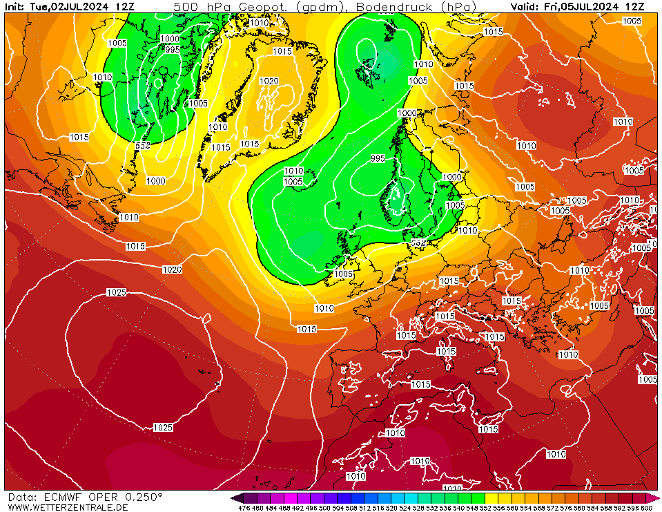
I wonder what the later stages of the ECM 12z will show. This is the 72hr chart
Originally Posted by: doctormog