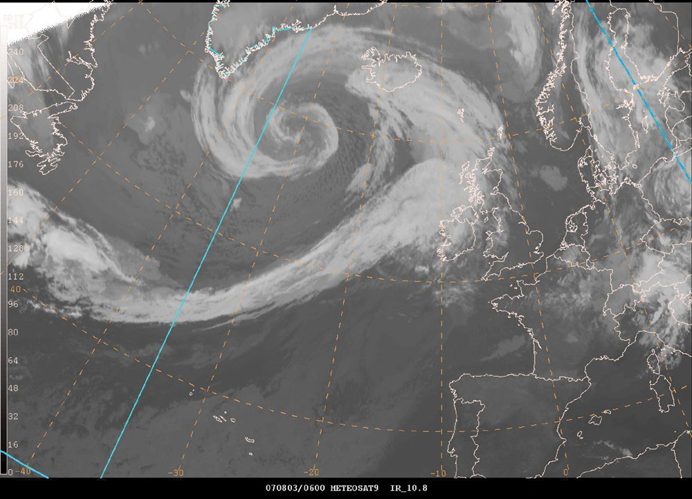
I think its started to loose its tropical characteristics. I admit it was not fully tropical, but I don't think its fair to say that it was fully extra-tropical either, it was highly symmetrical, an eyewall type feature was observed and the banding did not just look like an occluded front.
This is what a cold core occlusion looks like:

The cloud top is relatively warm and basically confined to a single spiral (where the occluded front is). However, this system had almost total cloudcover in the region surrounding the centre of the LP, plus one has to ask what mechanism caused the slight deepening earlier today?
At the very least the system that we saw had some tropical characteristics, although was not as impressive as I would have hoped.
Looking at the IR satellite earlier

To me this seems very convincing, I just don't think an occluded front would make this sort of pattern, and in fact I'm not sure if you would even be able to see this because the cloudtops would probably be a lot warmer than is showing here.
Do people seriously think they would be able to pick this out from a bunch of satellite photographs of tropical depressions? I'm skeptical, but like I say; probably a hybrid type system.
2023/2024 Snow days (approx 850hpa temp):
29/11 (-6), 30/11 (-6), 02/12 (-5), 03/12 (-5), 04/12 (-3), 16/01 (-3), 18/01 (-8), 08/02 (-5)
Total: 8 days with snow/sleet falling.
2022/2023 Snow days (approx 850hpa temp):
18/12 (-1), 06/03 (-6), 08/03 (-8), 09/03 (-6), 10/03 (-8), 11/03 (-5), 14/03 (-6)
Total: 7 days with snow/sleet falling.
2021/2022 Snow days (approx 850hpa temp):
26/11 (-5), 27/11 (-7), 28/11 (-6), 02/12 (-6), 06/01 (-5), 07/01 (-6), 06/02 (-5), 19/02 (-5), 24/02 (-7), 30/03 (-7), 31/03 (-8), 01/04 (-8)
Total: 12 days with snow/sleet falling.