The 18z was good enough for me! So here's round two, currently with a "start of deep cold" day of the 5th Feb.
Remember, these are for London on the Meteociel charts. The blue-haloed bit of the chart represents sub -15C runs.
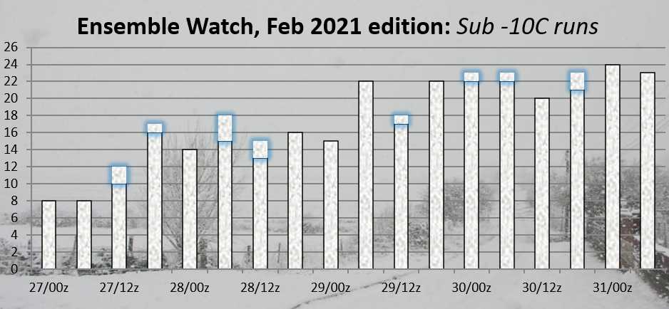
Round one maxed out as 16 members below -10 (of which 2 were below -15), so we're already ahead. Will that continue, or will this potential cold spell wilt away to nothing as per the last one? We'll see over the coming days.
Originally Posted by: Retron